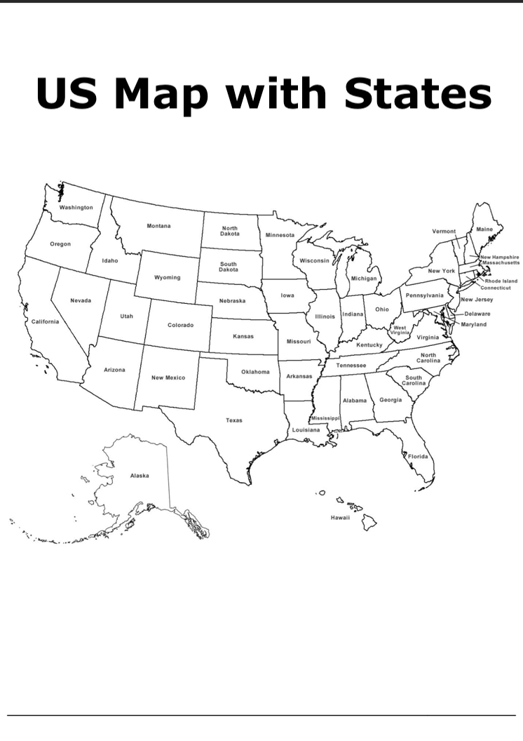
Learning the names of all the US states and their location is a basic tenet of American Geography. Whether you are a school teacher or parent looking to help a child learn the names of all the US states in context or a business person who needs a map of the USA with all of its states properly labelled, having a template Map of the US with State Names labelled is a useful resource to have on hand.
This PDF document that is easy to download, print and distribute provides a clear map of the USA with all of the state names marked on it.
| Language | Free |
| Release Date | 1998.09.01 |
| Genre | maps |
| Author | PDFGram™ |
| File Size | https://www.pdfgram.com |
| Rating | (5) |
If you are working with children, you could enlarge the template and cover the state names and create activities to test their knowledge of USA state names. This map is a great tool in helping them learn not only the names of all the US states but also their locations in context. You can also use it as a resource to help the class learn how state names are spelled. It can also be utilised as a great foundation for a more extensive research project.
As in the context of a classroom, a blank template map of the US with state names can be used as a starting point for many activities in the workplace. Whether you choose to use the map as part of a presentation, to create infographics or within a report, there are several ways to use it effectively in the boardroom context. You can also add to the map, for instance by showing people where the company already has operations or where you plan to expand to.
In short, although you may think that a tool as simple as a US map featuring the state names would be easy to come by, you’ll find that finding a blank template that isn’t already full of labels and annotations is often easier said than done.
This Map of the US with State Names is great because it is an excellent resource for reference. The map already displays general reference features like the state boundaries which provide an overview. With a blank canvas like this, users can also add other features such as the location of cities, state capitals, major highways, rivers and lakes and various terrain markers.
So, what are you waiting for? Book mark this reference or download this resource today!